


Voting District 0452152000063, Eaton County, Michigan
About
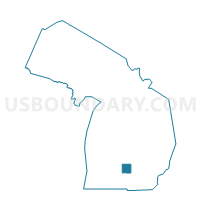
Outline

Summary
| Unique Area Identifier | 596367 |
| Name | Voting District 0452152000063 |
| County | Eaton County |
| State | Michigan |
| Area (square miles) | 1.10 |
| Land Area (square miles) | 1.09 |
| Water Area (square miles) | 0.01 |
| % of Land Area | 99.46 |
| % of Water Area | 0.54 |
| Latitude of the Internal Point | 42.74477430 |
| Longtitude of the Internal Point | -84.61125060 |
Maps


Graphs
Select a template below for downloading or customizing gragh for Voting District 0452152000063, Eaton County, Michigan


Neighbors
Neighoring Voting District (by Name) Neighboring Voting District on the Map
- Voting District 0452152000041, Eaton County, MI
- Voting District 0452152000053, Eaton County, MI
- Voting District 0452152000061, Eaton County, MI
- Voting District 0452152000062, Eaton County, MI
- Voting District 0452152000073, Eaton County, MI
- Voting District 0654600004012, Ingham County, MI
- Voting District 0654602000004, Ingham County, MI
- Voting District 0654602000006, Ingham County, MI
Top 10 Neighboring County Subdivision (by Population) Neighboring County Subdivision on the Map
- Lansing city, Ingham County, MI (109,563)
- Delta charter township, Eaton County, MI (32,408)
- Lansing charter township, Ingham County, MI (8,126)
Top 10 Neighboring Place (by Population) Neighboring Place on the Map
Top 10 Neighboring Unified School District (by Population) Neighboring Unified School District on the Map
- Lansing Public School District, MI (122,593)
- Grand Ledge Public Schools, MI (34,246)
- Waverly Community Schools, MI (20,625)
Top 10 Neighboring State Legislative District Lower Chamber (by Population) Neighboring State Legislative District Lower Chamber on the Map
Top 10 Neighboring State Legislative District Upper Chamber (by Population) Neighboring State Legislative District Upper Chamber on the Map
Top 10 Neighboring 111th Congressional District (by Population) Neighboring 111th Congressional District on the Map
Top 10 Neighboring Census Tract (by Population) Neighboring Census Tract on the Map
- Census Tract 201.03, Eaton County, MI (4,334)
- Census Tract 201.04, Eaton County, MI (3,661)
- Census Tract 35, Ingham County, MI (2,909)
- Census Tract 201.01, Eaton County, MI (2,829)
- Census Tract 34, Ingham County, MI (2,437)